What is “Aerial Photography in Real Estate”? And Its Importance.
Aerial photography in real estate is the use of aerial photography to capture images of properties, buildings, and the surrounding area for real estate purposes. Aerial photos provide a unique perspective of a property that can be difficult to capture using traditional ground-based photography. They can be used to showcase the size, location, and features of a property, and to provide a better understanding of the surrounding area and the property’s relationship to the surrounding environment.
Aerial photos are often used in real estate listings, virtual tours, and presentations to help potential buyers and sellers get a better sense of the property and its value. They can also be used to help with planning and development, as well as for other purposes related to real estate.
Table of Contents
1. Different Types of Aerial Photography in Real Estate
There are several types of aerial photography, each with its own unique characteristics and uses. Among the most common types are:
Oblique aerial photography: This type of aerial photography captures images at an angle to the ground, providing a more three-dimensional perspective of the subject. Oblique aerial photography is often used for real estate and architectural photography, as well as for capturing panoramic views of landscapes and cityscapes.
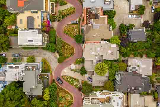
Vertical aerial photography: This type of aerial photography captures images that are directly above the subject, providing a top-down view. Vertical aerial photography is often used for mapping, surveying, and environmental monitoring, as well as for capturing images of buildings, roads, and other infrastructure.
Orthographic aerial photography: This type of aerial photography captures images that are vertically oriented and accurately represent the size and shape of objects on the ground. Orthographic aerial photography is often used for cartography, geology, and archaeology, as well as for creating detailed maps and 3D models of the terrain.
Low-altitude aerial photography: This type of aerial photography captures images from a low altitude, often from a helicopter or drone. Low-altitude aerial photography is often used for capturing images of large events, such as festivals, concerts, and sports events, as well as for capturing images of specific locations and buildings.
High-altitude aerial photography: This type of aerial photography captures images from a high altitude, often from a manned aircraft such as a plane or a satellite. High-altitude aerial photography is often used for capturing images of large areas, such as entire cities, regions, or countries, and for monitoring environmental changes over time.
2. What is “Aerial Drone photography “?
Aerial Drone Photography in Real Estate involves capturing images of properties, buildings, and other real estate assets from the air, using a drone equipped with a high-resolution camera. The resulting images can provide a unique and comprehensive view of the property, which can be especially useful for marketing and promotional purposes.
Drone photography in real estate is becoming increasingly popular due to the versatility, affordability, and high-quality images that drones can produce, and it is now common practice for many real estate agents and brokers to include aerial photos in their listings.

3. Capturing aerial photography in real estate involves the following steps:
Plan the shoot: Determine the best time of day for the shoot, based on the location and the type of real estate you are photographing. You should also determine the best flight path for the drone, based on the location and the desired perspective.
Choose the right equipment: Choose a drone that is equipped with a high-resolution camera and that is capable of capturing stable and smooth footage. Make sure to also choose a camera that is well-suited for aerial photography and that has the resolution and image quality you need.
Perform a pre-flight check: Before you fly the drone, make sure to perform a thorough pre-flight check, including checking the battery level, the GPS signal, and the camera settings.
Fly the drone: Fly the drone to the location and start capturing aerial photos. Make sure to fly the drone in a safe and responsible manner, and follow all local regulations and laws regarding drone use.
Edit and process the photos: After capturing the aerial photos, you can be sent to our editors for post-production. We are specialize in enhancing and retouching real estate images to make them look more appealing and professional. This can include tasks such as color correction, removing unwanted elements, and adding virtual staging to empty rooms. By outsourcing post-production to a specialized company like PixelShouters, real estate photographers can save time and focus on capturing the images, while ensuring that the final images are of the highest quality..
Share the photos: Share the aerial photos with your clients, real estate agents, or other stakeholders. This can be done by sharing the images directly, or by creating a virtual tour or presentation that showcases the aerial photos.
It’s important to note that aerial photography for real estate purposes requires a certain level of skill and experience, and it is highly recommended to have some training and practice before attempting to capture aerial photos for real estate purposes. It is also important to follow all local regulations and laws regarding drone use.
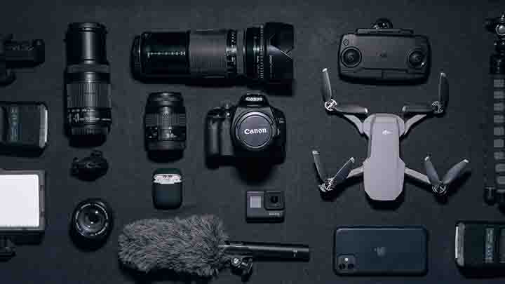
4. For aerial photography in real estate, the following equipment is typically used:
Drone: A drone equipped with a high-resolution camera is the most important piece of equipment for capturing aerial photos in real estate. There are a wide range of drones available, from consumer-grade drones to professional-grade drones, so it is important to choose a drone that is well-suited for the type of aerial photography you will be performing.
Camera: The camera is a key component of the drone and is responsible for capturing the aerial photos. For aerial photography in real estate, a high-resolution camera with a large image sensor is typically required to ensure that the images are clear and detailed.
Tripod or gimbal: Some drones are equipped with a tripod or gimbal that helps to stabilize the camera during flight, making it easier to capture stable and smooth footage.
Remote controller: The remote controller is used to control the drone and to adjust the camera settings during flight.
Software: Editing and processing software, such as Adobe Lightroom or Photoshop, is used to edit and process aerial photos after they have been captured.

Additional accessories: Depending on the type of aerial photography being performed, additional accessories, such as filters or extra batteries, may be required to ensure that the photos are of the highest quality.
It’s important to note that the specific equipment required for aerial photography in real estate will depend on the type of aerial photography in real estate being performed, the budget for the project, and the specific requirements for image quality and resolution.
5. Which camera is best in aerial photography for real estate?
For aerial photography in real estate, a high-resolution camera is typically required to capture clear and detailed images of properties and buildings. Here are a few cameras that are well-suited for this type of work:
DJI Mavic 2 Pro: This is a high-end drone camera that is specifically designed for aerial photography in real estate. It features a Hasselblad camera with a 1-inch CMOS sensor, capable of capturing 4K video and 20-megapixel still photos. The Mavic 2 Pro is also equipped with a 3-axis gimbal for stabilizing the camera during flight, making it ideal for capturing smooth and stable aerial footage.
Canon EOS R5: This is a full-frame mirrorless camera that is well-suited for aerial photography in real estate. It features a 45-megapixel sensor, capable of capturing high-quality still photos and 8K video. The EOS R5 is also equipped with dual-pixel autofocus, which provides fast and accurate focus, making it easier to capture sharp images while flying.
Sony Alpha A7R IV: This is another high-resolution mirrorless camera that is well-suited for aerial photography in real estate. It features a 61-megapixel sensor, capable of capturing still photos and 4K video with excellent image quality and detail. The A7R IV is also equipped with a compact and lightweight body, making it a good option for use with a drone.
It’s worth noting that while these cameras are well-suited for aerial photography in real estate, there are many other factors that should be considered when choosing a camera for this type of work, such as the type of drone being used, the type of aerial photography is performed, and the budget for the project.
Conclusion
In conclusion, aerial photography in real estate is a specialized form of photography that involves capturing images from the air. It is widely used in various industries, including real estate, where it is used to showcase properties and their surrounding areas in a unique and compelling way. To capture aerial photos for real estate, it is important to have the right equipment, including a drone equipped with a high-resolution camera, editing and processing software, and a remote controller. It is also important to have the necessary skills and experience to fly the drone and capture high-quality aerial photos.
By following these guidelines and using the right equipment and techniques, you can create aerial photos that truly showcase the beauty and value of a property.
